Houston is Awesome for Biking
Safe. Comfortable. Low-traffic. Beautiful.
Use the interactive maps below to find safe routes via bike lanes, low traffic streets, and trails throughout the city.
Never bike the same route you would drive in Houston and you'll have a lovely time!
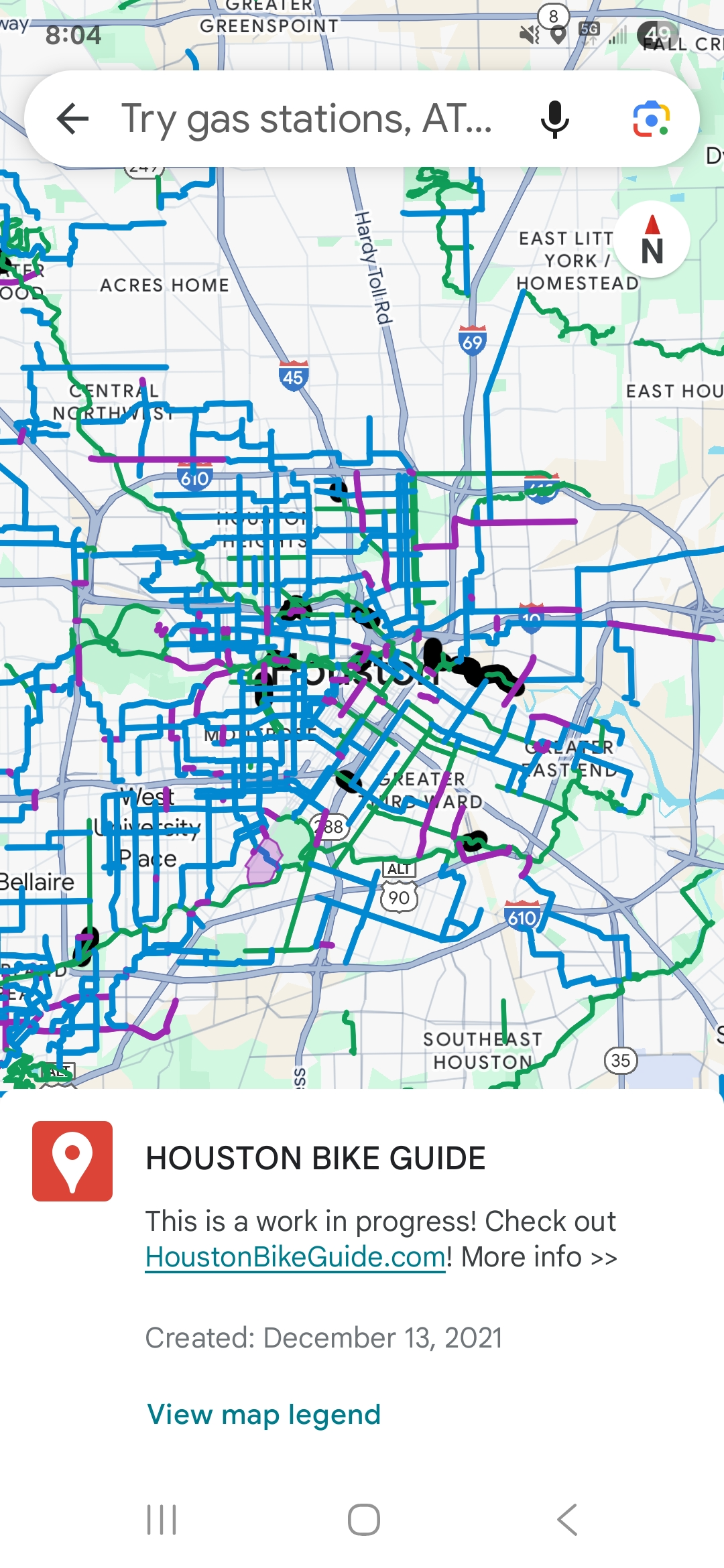
This is the Superways map — Houston’s bike through-routes connecting you between neighborhoods.
🚲 Almost 40% of Houstonians would bike if they felt safe. This guide is for them.
That’s according to a Kinder Institute survey — so we’re making safe, low-traffic routes visible and accessible for everyone.
We maintain a Google Maps version of the bike guide with helpful layers:
We maintain a Google Maps version of the Guide maps with helpful layers:
- Bikeable: These streets do not have official bike infrastructure, but they form the best routes with today's infrastructure to navigate between streets that are unsafe to bike on.
- Useful Sidewalk: Sidewalks that help people biking connect gaps in the bike network. Not first-choice pathways, but represent safe ways to access streets that are otherwise unbikeable.
- Bikeways: These lines represent many different kinds of bike infrastructure, some of which are off-street and some of which are on-street.
- Unpaved Bikeable: These paths are gravel or dirt that help make useful connections but may be unusable for some bikes or after heavy rain.
Learn More About the Project
These beautiful maps are professionally developed. A lot of volunteer work has gone into them so far, but we need more resources to cover the rest of the city and build the most helpful tools possible!
Help us Complete the Map!